


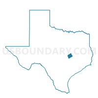
Voting District 0420, Milam County, Texas
About
Outline

Summary
| Unique Area Identifier | 675879 |
| Name | Voting District 0420 |
| County | Milam County |
| State | Texas |
| Area (square miles) | 118.92 |
| Land Area (square miles) | 118.74 |
| Water Area (square miles) | 0.18 |
| % of Land Area | 99.85 |
| % of Water Area | 0.15 |
| Latitude of the Internal Point | 30.60297930 |
| Longtitude of the Internal Point | -97.15501410 |
Maps


Graphs
Select a template below for downloading or customizing gragh for Voting District 0420, Milam County, Texas


Neighbors
Neighoring Voting District (by Name) Neighboring Voting District on the Map
- Voting District 0101, Milam County, TX
- Voting District 0105, Milam County, TX
- Voting District 0302, Lee County, TX
- Voting District 0415, Williamson County, TX
- Voting District 0419, Milam County, TX
- Voting District 0421, Williamson County, TX
- Voting District 0434, Williamson County, TX
Top 10 Neighboring County Subdivision (by Population) Neighboring County Subdivision on the Map
- Taylor CCD, Williamson County, TX (53,986)
- Rockdale CCD, Milam County, TX (8,315)
- Lexington CCD, Lee County, TX (4,789)
- Granger CCD, Williamson County, TX (4,697)
- Thorndale CCD, Milam County, TX (2,872)
- Davilla CCD, Milam County, TX (1,461)
Top 10 Neighboring Place (by Population) Neighboring Place on the Map
Top 10 Neighboring Unified School District (by Population) Neighboring Unified School District on the Map
- Rockdale Independent School District, TX (9,036)
- Lexington Independent School District, TX (5,590)
- Thrall Independent School District, TX (3,158)
- Thorndale Independent School District, TX (2,971)
- Granger Independent School District, TX (2,534)
Top 10 Neighboring State Legislative District Lower Chamber (by Population) Neighboring State Legislative District Lower Chamber on the Map
- State House District 20, TX (228,091)
- State House District 52, TX (219,345)
- State House District 17, TX (166,171)
Top 10 Neighboring State Legislative District Upper Chamber (by Population) Neighboring State Legislative District Upper Chamber on the Map
Top 10 Neighboring 111th Congressional District (by Population) Neighboring 111th Congressional District on the Map
Top 10 Neighboring Census Tract (by Population) Neighboring Census Tract on the Map
- Census Tract 1, Lee County, TX (4,789)
- Census Tract 213, Williamson County, TX (4,697)
- Census Tract 209, Williamson County, TX (4,601)
- Census Tract 9503, Milam County, TX (3,861)
- Census Tract 9508, Milam County, TX (2,872)
Top 10 Neighboring 5-Digit ZIP Code Tabulation Area (by Population) Neighboring 5-Digit ZIP Code Tabulation Area on the Map
- 76574, TX (17,661)
- 76567, TX (8,984)
- 78947, TX (4,475)
- 76577, TX (3,046)
- 76530, TX (2,540)
- 76578, TX (1,766)